Ein komplettes Paket zur
end-to-end IP


Überblick
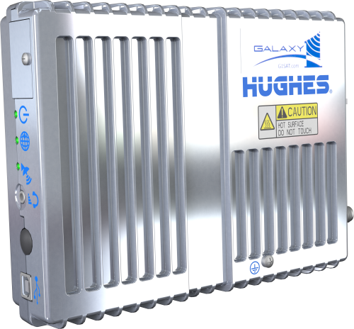
Das Hughes9502 ist eine Lösung zur Echtzeit-IP -Kommunikation mit einer entfernten Station über Satellit. Es verwendet das Inmarsat Broadband Global Area Network (BGAN) zur Verbindung der Station über die Campbell Scientific Software oder eins der IP-Protokolle, die unsere Logger unterstützen. Das Hughes9502 ist eine gute Alternative, wo Datenabfrage über Handynetz nicht möglich ist, da kein Netzabdeckung besteht.
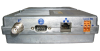
Das Paket enthält das Hughes9502 Terminal, eine gerichtete Antenne, Antennenkabel, Halterungen und Kabel zur Verbindung mit dem Logger und der Stromversorgung.
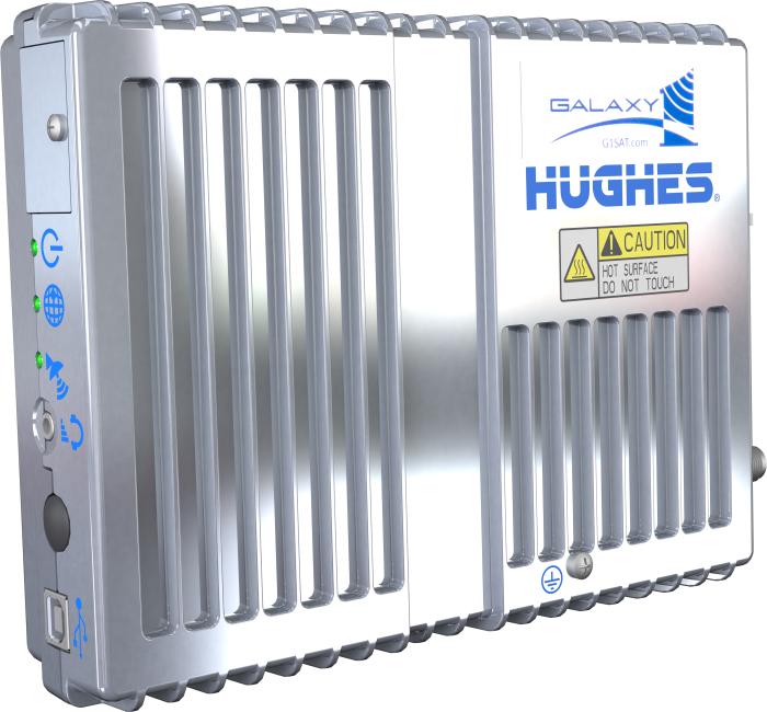
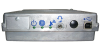
Im Bild oben ist das Hughes9502 mit dem 30456 Terminal Mounting Kit zu sehen.
Note: Das Hughes9502 bietet keinen Anschluss für eine ungerichtete Antenne.
Lesen Sie mehrFunktionen und Vorteile
- Everything you need to get started in one package
- Easy to set up and use
- Designed for BGAN M2M network services
- Provides reliable end-to-end IP connectivity
- All-weather operation
- Ideal for remote locations where cellular service is not available
- Multiple low-power modes suitable for operation on battery-operated stations
Bilder
Technische Beschreibung
The Inmarsat Broadband Global Area Network (BGAN) satellite network consists of three geostationary satellites: I-4 Asia Pacific, I-4 EMEA and I-4 Americas, which provide satellite data services around the world. A geostationary satellite does not change its position in the sky, allowing terminals to use much lower transmission power combined with a directional antenna, making low-power satellite services feasible. Because it uses L-band frequencies (1518 to 1675 MHz), the BGAN service is largely unaffected by rain fade, which causes signal degradation in some satellite systems.
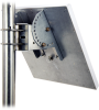
Stations using the Hughes 9502 must provide the flat, directional antenna with a good view of the southern (Northern Hemisphere) or northern (Southern Hemisphere) sky. Stations should be located between +75° and -75° latitude. Stations located at the extreme latitudes will need a better view of the horizon at low angles and are more susceptible to line-of-sight issues introduced by nearby buildings or mountains.
There are also multiple methods for addressing average power consumption. The unit can idle in a low-power state or easily be put to sleep under data logger control. Therefore, the Hughes 9502 can be a good fit for stations with a sensitive power budget.
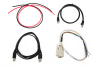
The 31447 HUGHES9502 Parts Included Kit that ships with the HUGHES9502 includes the following:
- (1) 31440 Power Wire Set of Red and Black Wires, 2 ft
- (1) 28899 CAT6 Ethernet Unshielded Cable, 2 ft
- (1) 17856 Serial Cable, DB9 Female to Pigtail, 2 ft
- (1) 17648 USB Cable, Type A Male to Type B Male, 6 ft
Communication Performance
Information provided by Inmarsat: "Send data using BGAN Standard IP at a rate of up to 448kbps with a low latency from 800* milliseconds, assuring real-time visibility of critical data."
* "Please note latency is dependent on the end-to-end routing and this figure cannot be guaranteed."
Campbell Scientific has observed the following:
- Raw upload (data logger to Internet) speeds: 100 kbps typical
- PakBus payload upload speeds: typically greater than 12 kbps
- ICMP ping time: 1 second typical
- PakBus ping of 1000 bytes: 2.5 seconds typical
Note: Data transfer speeds can vary depending on location, signal strength, and the protocol used.
Kompatibel mit
The HUGHES9502 can directly connect to the Ethernet port on a CR310, CR6, CR1000X, or CR9000X datalogger. Other data loggers require an Ethernet interface such as the NL201, NL116, or NL121 to connect the HUGHES9502. The HUGHES9502 also requires SIM card activation and a data service plan, such as used by a cellular telephone or Iridium satellite modem.
Use of the Hughes 9502 requires a BGAN/M2M service agreement with an Inmarsat service provider. When choosing a provider, evaluate their service while comparing costs. Most plans have a monthly base service fee for each subscriber, as well as charges for the amount of airtime or data used. Contact Campbell Scientific for more information about communications or assistance in locating a provider.
Spezifikationen
| Nominal Input Voltage | +12 Vdc or +24 Vdc |
| SIM Card Type | USIM (USIM already included) |
| Water & Dust Ingress Protection Rating | IP-40 Compliant |
| Operating Temperature Range | -40° to +75°C |
| Storage Temperature Range | -55° to +75°C |
| Humidity Tolerance | 95% RH (at +40°C) |
| Transmission Distance or Area | Worldwide between +70° and -70° latitude |
| Service Requirements | Needs a USIM card to work on the satellite network. Must select a service provider and pay a fee. |
| Dimensions | 150 x 200 x 45 mm (5.9 x 7.87 x 1.77 in.) |
| Weight | 1.12 kg (2.47 lb) |
Frequency |
|
| Satellite Transmit | 1626.5 to 1675 MHz |
| Satellite Receive | 1518 to 1559 MHz |
| GPS | 1574.42 to 1576.42 MHz |
Power Consumption |
|
| Transmit | < 1.667 A (@ 12 Vdc) |
| Narrow Beam without Transmit | 250 mA (@ 12 Vdc) |
| Idle (Regional Beam) | < 0.833 mA (@ 12 Vdc) |
| Off (Wake on Packet) |
|
| Off (GPIO Control) | 0 mA (@ 12 Vdc) |
Interfaces |
|
| Power Input | Screw terminal, reverse polarity protected |
| Antenna Connector | TNC jack |
| Ethernet | 10BaseT, RJ45 connector (used for data logger or PC communications) |
| USB Connector | Type B (used for PC communications) |
| RS-232 Connector | GNSS DB9 (used for GPIO sleep pin control) |
Antenna |
|
| Wind Loading | Survival wind loading up to 160.93 kph (100 mph) |
| Water & Dust Ingress Protection Rating | IP-65 Compliant |
| Cable Connectors | Type N male-to-type N male (Type N-to-TNC adapter included for antenna-to-terminal connection) |
| Cable Length | 10 m (30 ft) |
| Dimensions | 38.5 x 38.5 x 3.3 cm (15.2 x 15.2 x 1.3 in.) without mount |
| Weight | 1.85 kg (4.08 lb) without mount |